Wednesday, June 22, 2016

Ever feel like you're being followed?

Our stay in the Dragon's Den in Watson Lake was uneventful.  When we got up, we checked on the weather forecast, and found rainshowers and thunderstorms predicted for our entire route.  It seems that as we drive out of this weather system, it catches up with us and follows us east.  At any rate, we were able to hand in our passport entries for the Yukon Adventure contest (we had more than enough stamps).  The Passport theme for the contest seems to me to be quite a good one.  We definitely visited many places we might otherwise have passed by, and for the most part, they each imparted a bit more information about the places we were visiting.  Because of the weather forecast, we phoned ahead while we could, to stay at the Liard River Lodge, a hotel across the street from the Hotsprings Park, and got confirmed reservations.  We then continued east and south, crossing out of the Yukon and into BC several times before we were finally out of the Yukon Territory for the duration of our trip.  We passed three more bears - I won't bore you with another bear picture, but they certainly aren't endangered here.  We also passed several lone bison, and a few groups, for a total of 7 bison (I have to give you our wildlife count!). These bison have no fear of traffic.  In fact, they apparently occasionally get angry with cars stopped nearby them, and attack and total them! We stopped for a snack at a cafe about 100 km out of Watson Lake, and had to settle for stale coffee and a chocolate bar, as the cafe was really only a gas bar.  Pretty much all the restaurants and cafes have closed down along this stretch of road. 
Bison

This one was getting too close to the car.

When we arrived at Liard River we checked into the Hotel to discover that the wi-fi they advertised, and the restaurant they featured.....were closed and not available.  We'd deliberately not purchased groceries in Watson Lake on the premise we'd be at a motel with a restaurant, so other than a bit of wine, crackers, cheese, and bread, we had nothing and no way for lunch or dinner.  So I got back my money and we decided to forego the hotsprings.  It may have been dangerous to bathe in them in thunderstorms, anyway.  Continuing eastbound on the highway, we decided to fake it, and if worst came to worst, we could make it a long day and find a place in Ft. Nelson.  Just east of Liard River we passed several more bison, and then had a few construction delays as we entered into the Northern Rocky Mountains.  No restaurants or grocery stores, or campsites available for hours.  But at Muncho Lake we came to a very high-end Lodge, the Northern Rockies Lodge.  Here we were able to get a  restaurant....but alas, the chef had closed the restaurant an hour ago, after lunch, and was preparing dinner for re-opening in 4 hours.  They did allow us to order food to go, and we got some very nice schnitzel and fries, half of which we consumed right there, and kept the rest for dinner.  We then continued on a very pretty drive along Muncho Lake, winding into the mountain valleys.  At 1600 we came upon a spot with cabins, rooms, rv and camping spots, as well as gas pumps and a restaurant.  We were able to get a cabin here, and found it extremely pleasant, roomy, and clean.  Situated on a small lake created by a resident beaver, with wi-fi available, we were happy.  It continued to rain off and on all day and evening, but it didn't dampen our spirits, as we'd discovered a gem of a place here at Toad River - and it cost less than the Liard Room would have.  We watched a moose foraging on the far side of the lake, several swans and ducks were paddling around.  All was good.  This weather continues to follow us....forecasting sunny skies a day or two beyond our range, but then changing to rainshowers as we go on.  It just seems to mean more rooms and less camping for now.  On day 28 of our vacation, we've now gone 7800 kilometres, and spent 13 nights in the tent, 13 in hotel/motel rooms, and 2 with friends.  All is well.  Stay tuned for the rest, as we try to get out of the rain.


First view of Muncho Lake

Moose munching at the lake

Parked at our cabin....the moose is on the far side of the lake to the right of the cabin.


Tuesday, June 21, 2016

Get a Room!

It was a good thing we'd booked into the Atlin Mountain Inn last night, in spite of the limited food options - it rained all night, and got quite cool (ok, maybe even cold!).  But we'd had a great, quiet night in our hotel room.  We made coffee in our room, and had some of our cheese and baguette from our camping leftovers, and then started out.  Before heading back to the Alaska Highway we continued out of town a few km to walk through the Pioneer Cemetery.  There was no-one there we knew of, but still find them interesting....one fellow, an aviator,  died of starvation in the early days of the town, and many of them died in mining accidents. We were impressed with Atlin, in spite of the rainy, cloudy weather - what we saw gives us  an idea how magnificent it would appear on a sunny day.

An old ferry on the beach at Atlin. 
 It continued to rain off and on throughout the morning, and by 11:00 AM we were back eastbound on the Alaska Highway, bound for Teslin.  We made a stop outside of Teslin at the Tlingit Heritage Centre, where we viewed an impressive display of Tlingit artifacts and artwork.  They were preparing for Aboriginal Day, with free bbq'd burgers and bannock.
A beautiful mask and a Bentwood Box

I love the artistry in the masks

Tlingit Totems
Just a few km further on, we visited a museum dedicated to George Johnson, a native photographer and leader of the community.
We were then into Teslin, and it was just past 1230 - perhaps too early to settle in for the night, so we headed back down the highway in brightening skies (although still drizzling most of the time).  This part of the route was basically just winding our way through a bit of mountainous country and past some lakes, over the Divide (we didn't stop here this time), and on into Watson Lake, where we'd originally entered the Yukon.  We'd outrun the weather system and found warm and sunny weather here....but it was behind us, moving our way, with the wind picking up ahead of it, as it had the previous two days in Whitehorse and Atlin.  So time for another room.  We found a vacancy in a small, clean, but older motel - the Dragon's Den (I don't think this has anything to do with the tv program).  It was only 5PM so we took a drive out to the airport, 8 miles north of town (to get another stamp for our passport, which we'll hand in tomorrow morning).  Here they had a great set of pictures depicting the Lend-lease program during WWII, when thousands of US aircraft were ferried through here to the Soviet Union to assist in the war against Germany.  I was also taken by the old control tower, which reminded me of my first control tower in North Bay.
Terminal Bldg. and Control Tower at Watson Lake Airport


On our way back into town, I marvelled at how long some of the highway signs around here have lasted!
Remnants of the 70's

As I sit here in our snug little room, we're working on our next routing.  Because of the flooding and highway closures on highway 97, we'll likely detour a bit into Alberta before turning south to Jasper and then back toward home.  Tomorrow we're bound for the Liard River Hotsprings for a soak - if we can get a campsite.

Monday, June 20, 2016

Thank God for Pubs!

Whitehorse continued to entertain us, with another full day on Sunday.  We had a nice clear, warm, sunny day so headed off to the Yukon Wildlife Preserve, to see if we could catch sight of some of the wildlife we'd been unable to spot along the roads so far.  We had a choice of a bus tour through the area, or do a self-guided 5 km walk.  Being thrifty, we chose the latter, and spent a little over 3 hours walking the roads to see Wood Buffalo, Caribou (well, sort of - even here they hide a bit), mountain goat, thinhorn sheep, lynx, arctic fox, red fox (okay....we've seen a few of these already), moose, mule deer, and elk.  It's sort of like visiting a zoo I guess, but we did enjoy the walk, and seeing the animals.
MuskOx

Bison/WoodBuffalo

On the way back into town we stopped at a copper mining exhibit, as Whitehorse area is partially built on the history of copper mining.  It was also worth another passport stamp.
Train Ride at the Coppermining exhibit

Back in town, we visited another First Nations Interpretive Centre, and returned to the steamboat, S.S. Yukon, for a better look around and to check out the movie which we'd missed the previous day.
After that and a bit of grocery shopping, we were ready to return to camp to eat that barbecued chicken meal we'd bought.  It was still pleasant and early, so another hike/walk was in order.  We walked from our camp to the nearby Yukon River, and crossed a bridge to an island to circumnavigate the island on a nature trail.  Then, back across the bridge, we walked along the river to a large power dam project, with a very large fish ladder for migrating salmon to get by the dam.
A Beautiful War Canoe at Interpretive Centre

Power Dam/Fish Ladder on the Yukon River

By the time we'd returned to our tent, the wind was piping up and the temperature dropping. We spent a restless night in the tent, and packed up as the clouds rolled in.  All of this was not unexpected....the weather forecast was correct in predicting this weather, with showers later....so we'd pre-booked a room at the Atlin Inn, in Atlin B.C., some 225 km southeast of Whitehorse.  The showers held off for most of our drive, and we were able to stop at White Mountain for a short (1.5 km) hike up the mountain to look for mountain goats (nope - good thing we'd seen them at the preserve!).  We passed a sow bear with three cubs, and stopped for a pleasant lunch (yup - leftover chicken and salad) beside Como Lake.  We'd originally had plans to maybe spend the solstice north of the Arctic Circle, but we are now more than 500 miles south of that, so Atlin sounded like a good alternative, being quite scenic and still fairly far north.  We found that there is only one restaurant in town which closes at 7 PM,  and most of the town is shut down.  But it has a lot of potential for a toursit mecca, and they even have a Music Festival here (July 8-9) headlining Bruce Cockburn.  We checked into the Atlin Inn, a very nice, clean place.....and they have wi-fi.  We did a walk around town (3 streets) and then headed to the restaurant,but a sign on the door apologized for the fact they had to close for the day. Hmmmm.....we did have cheese and crackers in the car, so planned on a simple dinner.  But - back to our hotel, the proprietor had heard the news, and put on smokies in the bar....so we had a few beers with smokies for dinner, and chatted with the locals - a very friendly bunch.  So thank God for pubs....without this one, dinner would be a few crackers and cheese!  Then back to our room to write up this posting and eat dessert (cherries left over from the previous day).  Tomorrow we'll be back eastbound on the Alaska Highway, likely stopping a few hundred km east, at Teslin.


Momma Bear and 3 cubs....one of them is a brown black bear
The view from our hotel window

Exploring Atlin


Sunday, June 19, 2016

More off the Bucket List, and History Lessons


A Transport Truck overturned on the Dempster
Having “Done the Dempster” we decided to work our way back Southbound to Whitehorse, so we headed eastbound on the Klondike Highway which joins Whitehorse to Dawson City. After about 30 km., it was time for a snack, so we stopped at a community called Moose Creek....which has a reputation for fabulous baked goods. They take their name seriously, as all four homes in the community, as well as several signs, and even a doghouse, are moose-antlered. We had a coffee and sausage pastries, with blueberry tarts – all freshly made and yummy.
Even the Dog House in Moose Creek sports a Rack

A fat porcupine
Then continuing on to the Stewart River, where we turned north to follow alongside the Stewart, up the Silver Trail to the village of Mayo. Here we learned of the history of the area, which had originally started out with the gold prospectors, but became a steamboat landing and a centre for silver mining operations when silver was discovered in the area. We got another stamp for our Yukon Passport here, so that we can win some gold for our travels, and visited a museum, the Binet House. It was starting to become late afternoon, so we continued north a few more km., and set up camp in a Territorial Campsite on 5 Mile Lake...very pleasant camping. Our hatchet is very poor at splitting the logs the park service provides, so I had to borrow an axe from a neighbouring campsite, so that we could finish off our dinner with a sit around a campfire sipping wine. The following day we continued on another 50 km., to the hamlet of Keno. On the way we stopped to photograph a fat porcupine waddling alongside the road.
Travelling up the Silver Trail


The community of Keno is refurbished as an old pioneer town, with the 4-building museum being the centrepiece. There are also two restaurant/saloons, and a couple of houses. At one time, this was the principal silver mining area of Canada (perhaps the world), but now there is only one mine in operation, and I believe it's in the process of shutting down. As the town went into remission, the fellow who runs the museum kept collecting and filling up his buildings with artifacts – and it is quite a collection to behold, with household articles, mining and prospecting equipment, and general memorabilia. We managed to spend a fair bit of time viewing all of this, and then decided to view the signpost for which Keno is famous – it's up on top of a 12 km. Climb, some 6000 feet up behind the community, and offering spectacular views down the Stewart River Valley as well as another roadworthy challenge to get there.
Keno City Mining Museum (one of 4 buildings)

Signpost on mountaintop above Keno

Looking out over the Valley

Having ventured up the mountain, it was time to head back again (we were at the end of the road again), so stopped into Mayo for some groceries, and then continued to the Stewart Crossing at the Klondike Hwy. A short visit with the visitor information fellow at the Junction was interesting, as he showed us his many photos taken here in his past 40 years here.....wildlife photos, aurora in almost unimaginable displays, and awesome scenery shots. We then continued south to Pelly Crossing where we visited another Interpretive Centre/museum (big Jonathon House) which we found only mildly informative...but we got another Passport stamp. Then it was on to another Yukon Territorial Govt. Campsite at Tatchun Creek. We'd run out of beer, so I had to settle for a root beer for happy hour. This was another fine campsite, with a stream running behind our tent. The stream provided a number of bucketfuls of water to sluice off some of our Dempster muck (no carwashes to be found anywhere!). Several beaver dams and lodges were situated nearby, and Linda was impressed with the size of trees the animals had been able to fell for their dams. Again we had a nice little fire in the evening, and I crammed for my Sam Magee recitation, which would be due the next day.
Tatchun Creek Campsite

Beaverdam...Linda was impressed by the size of the birch tree felled here

The following morning was cool, but very pleasant weather, and we were off fairly early, stopping at the Tage Cho Hudan Interpretive Centre, which this time we found extremely interesting and informative regarding the First Nations in the area. A short way further down the road was a brunch stop. We'd met hundreds of motorcycles northbound, and learned that there was a “rally” (the Dust 2 Dawson Motorcycle Gathering – not a Rally) in Dawson City this weekend – likely to be a great success if the numbers of cycles is a measure. Another hundred km., and we were at Lake Laberge. There is a government campground here, but it was packed full....so I was able to stand on the marge of Lake Laberge and made my recitation, before continuing toward Whitehorse. We checked out a campground at a Hot Springs (Takhini Springs), but didn't like the looks or the prices there, or the long lineup to get in. There is a Game Refuge nearby, so here we saw our first elk.
Reciting "The Cremation of Sam Magee" at Lake Laberge

Elk

So we entered into Whitehorse and found the Robert Service Campground which caters to tenters, and found a great little spot within walking distance of town, and (bonus!) delicious ice cream cones. With time to spare we went on into town and found at the visitor centre a warm welcome, a free parking pass 
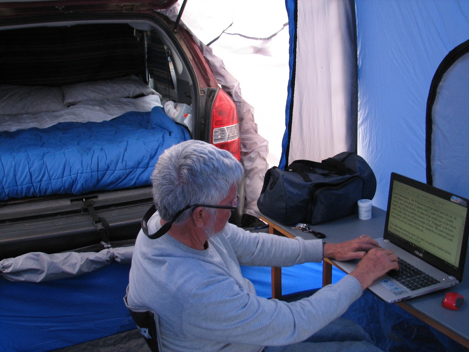
for 3 days in town, great wi-fi (I got the last blog issue posted finally). We also discovered information on a local restaurant which serves Arctic Char, so dinner was decided – you may remember that was another item on my bucket list. While we were out, there was a short thunderstorm, but our camp survived nicely, and perhaps even washed off some dust. Following our beautiful Char dinner, we came back to camp, had a short walk along the Yukon River, and called it a night.
Saturday (18th) dawned warm and dry and clear. We filled our day with exploring the city of Whitehorse, and getting educated at museums – Beringia Interpretive Centre (history of the Yukon from pre-glacial times onward), Transportation Museum, old log church, steamboat S.S. Klondike, and of course a tour of the local microbrewery, the Yukon Brewery, who make “beer worth freezing for”. We were also interested in learning that they distill single malt whisky, and the first two batches sold out immediately. Next batch is out in July, but I couldn't pre-purchase any (I'd hoped that would make a good addition to a tasting on our return). As we'd spent a couple of days' budget on our char dinner the previous night, we hit up the local Superstore and got some groceries for a simple meal at home at the tent. I was surprised to find cherries at a reasonable price, so we had dessert sorted out (along with some more of the fine ice cream offered at the campground). 
Arrival Whitehorse

Huge skeletal remains of a mammoth at Beringia Centre

DC-3 Windvane (it works even at 3 kts wind) at Transportation Museum

Single Malt aging in its barrels

A 3-story log cabing skyrise in Whitehorse


So now I've scratched off a few more things from my bucket list.....getting through the poem at Lake LaBerge, and having an Arctic Char dinner among them.  We'd also learned a huge amount of history, from pre-glacial to recent, due to the many interpretive centres, museums, and passport stops.  Today is Father's Day - Happy Father's Day to all of you fathers out there.  It will be our last day in Whitehorse today, as we visit the Game Preserve to see more than the elk, and a bit more touring of the town.  Tomorrow the plan is to head south about 180 km., to Atlin in northern BC.   While we're close, we want to check it out.  Then we'll be turning eastbound again on the Alaska Highway.  Blog postings may get intermittent again from here....not sure how much wi-fi will be available.

Friday, June 17, 2016

Inuvik and other Adventures

As I'd mentioned previously, we arrived in Inuvik in the afternoon, with a chance to orient ourselves a bit to the town and set up camp in the Happy Valley Campground, which is right in town. The drive up the Dempster caked the car with a lot of dust, mud, and who-knows-what. So before attaching our tent to the car, I was able to give it a wash in the local car-wash. No soap, just a high pressure wand, and about 30 seconds of water per looney – so suffice it to say it was a quick rinse only. With our camp set up we walked the town. There are a few “touristy” spots to see, such as the Catholic Church which was built to resemble an igloo. Also the Inukshuk on a main corner of town – this is the one that was used as the Canadian emblem on stamps and also used for the Olympics.

Inukshuk with Igloo Church in the Background

Being built on permafrost, all of the buildings lack a foundation, but are jacked onto support posts instead, which can be adjusted. Throughout the town is a utilidor system – dual insulated pipes serving sewer and water utilities to the buildings.
Utilidor System serving sewer and water in Inuvik

In our travels up to now, most of the indigenous populations were various indian groups/nations. Inuvik is largely Inuvialuit (Innu, formerly Eskimo). We decided to celebrate our successful incident-free trip on the Dempster Highway by a restaurant meal, and settled for Chinese food in a local diner. Then it was back to the camp to type up some Blog material and get out of the rainshowers which showed up.
Blogging from the tent, in Inuvik

The following morning (Monday) turned out to be absolutely beautiful – a cloudless bright blue sky with warm temperatures. Locals tell us it was the “Best day of the Year” - something that happens that infrequently. It warmed up to 22 degrees Celsius, and the dreaded and anticipated hordes of bugs never arrived. After a late breakfast, we took a walk to the East Channel of the Mackenzie River, where I dipped my toe in the cold muddy waters – in case this is as close to the Arctic Ocean as I can get!
Dipping my toes in the East Channel, Mackenzie River, Inuvik

We managed to get some wi-fi so checked our e-stuff and sent out the previous two Blog posts. Tundra North Tours is a company who specializes in Delta boat tours, boat trips down the Mackenzie to Tuktoyuktuk, and aircraft tours. We got a bit of a discount to put our names on a waiting list for an aircraft tour to Tuk, and ended up getting it when a few others signed on to make a party of 4. So at 5PM we were driven to the airport and boarded a single-engine Cessna 207, flying north along the Mackenzie and over the Delta, circling the old settlement of Reindeer Station (the site of a great herding migration of reindeer by the locals to save the herds), an old DEW line station from the days of the cold war, and finally Tuktoyuktuk itself, lying on the Beaufort Sea on the Arctic Ocean.
Inuvik from the Air

Mackenzie R. Delta...the curved river is the East Channel, the main Channel wider and beyond

Reindeer Station from above

Our local guide, John, drove us around the village, showing us a Pingo (hillock formed by the permafrost) and unique to this type of Tundra terrain.
2nd Largest Pingo in the World (Largest is in Russia) viewed from the air

Same Pingo....from sea level

We visited a beach on the ocean, where I was able to wade in the water (more than just a toe) and taste it (almost no salt in this water due to huge amounts of Mackenzie River freshwater mixed in).
Wading in, and tasting, the Arctic Ocean from Tuk

Children in Tuk like to play in the Arctic Ocean

The locals are just starting to set up their hunting/smoking camps for the beluga whales and fish which will soon return to the area – these provide food for these people who still live in a mixed traditional and modern way.

Setting up Camp for Hunting Belugas and fishing, smoking meat

A view of the New Highway to Tuk (finished in 2 years?)
On the flight back, we flew direct to Inuvik, passing over the new highway being built to Tuk. Looking at the number of lakes and water obstacles, and being built on permafrost, I was amazed at the engineering skills that must have been utilized to build it.
Many of the lakes we passed over were still iced in

By 10 PM we were back in town, and tired and hungry, we stopped for a quick pizza and hit the sack. During the night, the temperature dropped to near freezing, and the wind piped up to gale force. We got very little sleep with the rattling tent, so at 6AM it was time to pack it up. The forecast was for a cold, wet day with snow flurries for the next morning. We'd had our best day of the year, and now it was time to head south. The drive back on the Dempster was this time through numerous rainshowers, although we apparently missed most of the heavy rain. We caught the two ferries right away, and felt our way through the mountains, White Pass, and past the Arctic Circle marker, in 100 foot visibility in fog. At the halfway mark on the highway, we pulled into the Eagle Plains Hotel, too tired to go on, and too cold to set up camp. So here I am in a nice warm room, but without wi-fi again (this seems to be a common problem up here). When we get in range, you will get this posting, with whatever updates we can prepare. 
It rained all night, and by morning was close to freezing.....so I guess the forecast was right! After a quick breakfast (coffee and muffins) we set out early to finish doing the Dempster.  With the rain of the previous night and day, the road was muddy and slick.  Not as much low cloud and fog as earlier, but quite slippery.  We have no major wildlife to report, but by the time we reached the end of the highway we'd passed 5 RV's and several trucks who had flat tires....a few of them were on their second flat!  We were lucky, and only had a ton of mud, some of which we scraped off with a stick.  We were now at the halfway mark of our trip, timewise, and had logged 2 km. short of 6,000 kilometres so far.  Depending on what side trips we do on the way back, it may not be quite as many for the return.  At the end of the Dempster, we were 30 km. east of Dawson City, but instead of turning west to return there, we turned east  and south, toward Whitehorse, the Capital city of the Yukon, and the largest city also.  I'm filing this blog from there, but I haven't yet written up our trip to get here, with the side-adventures.  Hopefully I can get back to the Information Centre again tomorrow to update everyone on that, and get up-to-date.  We've just learned that the storms we got to the north threw lots of water at Dawson Creek and Fort St. John area, with the return highway 97 closed due flooding and washouts.  We will be another week before we get that way, so things may change.....either the highway will open, or we'll find a different route.
Until later.......DJ